
Assessing the historic impact of HS2
WHERE DO WE START?
The proposed route for HS2 covers roughly 40 miles as it crosses Buckinghamshire from end-to-end. All along the route there are ancient sites, historic landscapes and listed buildings: Denham, the Chalfonts, Amersham, the Misbourne Valley, Wendover, Hartwell and Aylesbury, Quainton, Twyford, Chetwode – and any number of old farms and smaller settlements in between.
So where do we start? The Chiltern Society had already started to gather evidence for the likely impact of HS2 in the southern half of the county, the Chilterns. At the same time the Chilterns Conservation Board was preparing a set of maps showing both environmental and historic features of the Chiltern landscape that would be affected.
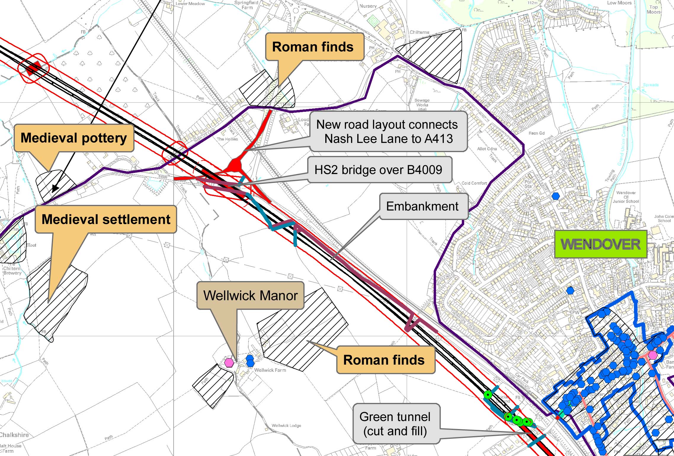 The CCB map on the right shows a section of the line where it passes Wendover, with the town's listed buildings shown as blue dots.
-
These excellent maps are now available on-line at
HS2 Chilterns Historic Environment Maps.
BAS Council therefore decided:
- To focus on the northern half of the county;
- In view of the short ‘consultation’ deadline set by the government, to do one in-depth study of the
impact of HS2 on the historic environment of one village, as a ‘test case’;
- With the option of running other, ‘spot-check’ surveys elsewhere, if there was time before the deadline.
- Twyford was selected for in-depth study and a detailed impact assessment.
- Chetwode would be the first ‘spot-check’ survey.
- Potter Row, in the Chilterns, would be a second ‘spot-check’ survey in the south of the county.
For details of the project's current activities and future plans,
eMail the project coordinator
![]() Marian Miller
.
Marian Miller
.
MAP BY THE CHILTERNS CONSERVATION BOARD