
Chetwode Village Survey
PART OF THE HS2 HISTORIC IMPACT ASSESSMENT PROJECT
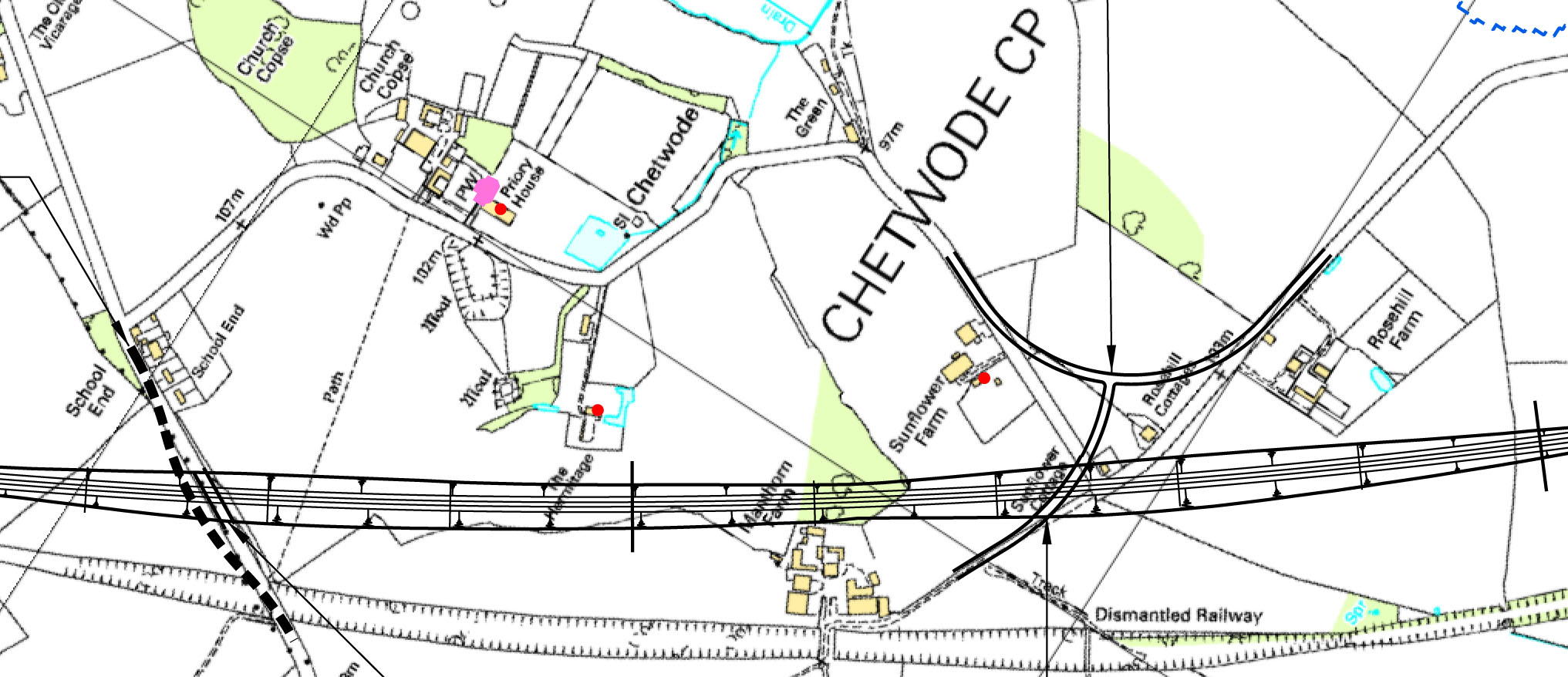
MAP OF CHETWODE, showing the old railway line (bottom) with the planned HS2 route closer to the village. This is a section of the official map issued by HS2 Limited for public consultation.
Chetwode was included in the society's
![]() Response to the HS2 Environmental Statement in February 2014.
Response to the HS2 Environmental Statement in February 2014.
Click here to read
![]() the section on Chetwode
.
the section on Chetwode
.
 Three members of BAS converged on the small village of Chetwode, just inside Buckinghamshire's border with Oxfordshire in the far
north-west, on 25 June 2011. The HS2 high-speed rail line is planned to pass close to the village, demolishing at least two houses
and passing close to several moats which are believed to be medieval in origin.
Three members of BAS converged on the small village of Chetwode, just inside Buckinghamshire's border with Oxfordshire in the far
north-west, on 25 June 2011. The HS2 high-speed rail line is planned to pass close to the village, demolishing at least two houses
and passing close to several moats which are believed to be medieval in origin.
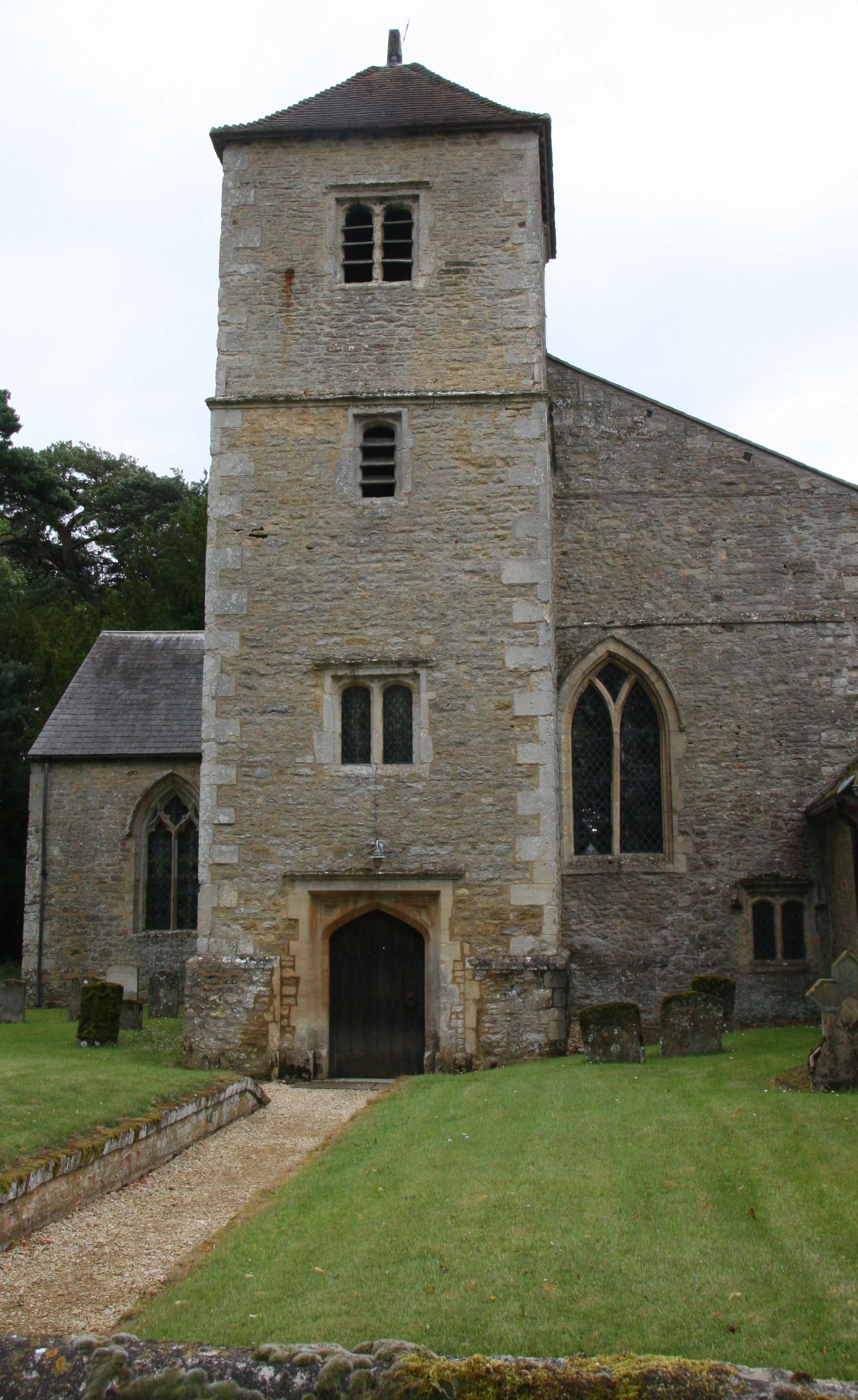
In the middle ages Chetwode was the site of an Augustinian priory, the chancel of whose church today serves as the Grade I listed parish church (pictured right). The building itself dates from 1244. It has the most amazing collection of windows, dating from various periods of its history. In one of these is the oldest stained glass in the country. If HS2 is built as planned, the church will be 100 metres from the line.
The survey day included visits to four houses in Chetwode, all listed Grade II: The Hermitage, Priory House, Sunflower Farm and Chetwode Manor. The Hermitage was originally named Wells Farm, stands on a moated site and has a second moat – possibly an ancient fish pond – in its garden. Priory House contains the shell of the 16th-century house built from the dissolution of the priory. Sunflower Farm has an unusual 'winder' staircase in a stone-built staircase tower. Parts of Chetwode Manor are reputed to date fronm the reign of King John.
The survey concluded with a field walk along the abandoned line of the former Great Central Railway, which passes Chetwode at different points on a high embankment and in a deep cutting. The new HS2 line would cut the corner, coming closer to the village.
For full details and recommendations, see:
![]() Chetwode : BAS Report 2011-05 - June 2011
Chetwode : BAS Report 2011-05 - June 2011
![]() Chetwode : BAS Response to the HS2 Environmental Statement - February 2014
Chetwode : BAS Response to the HS2 Environmental Statement - February 2014
PHOTO BY PETER MARSDEN. MAP BY HS2 LIMITED.