
Twyford Village earthworks – the medieval manor site?
PART OF THE HS2 HISTORIC IMPACT ASSESSMENT PROJECT
The village earthworks were included in the society's
![]() Response to the HS2 Environmental Statement in February 2014.
Response to the HS2 Environmental Statement in February 2014.
Click here to read
![]() the section on Twyford.
the section on Twyford.
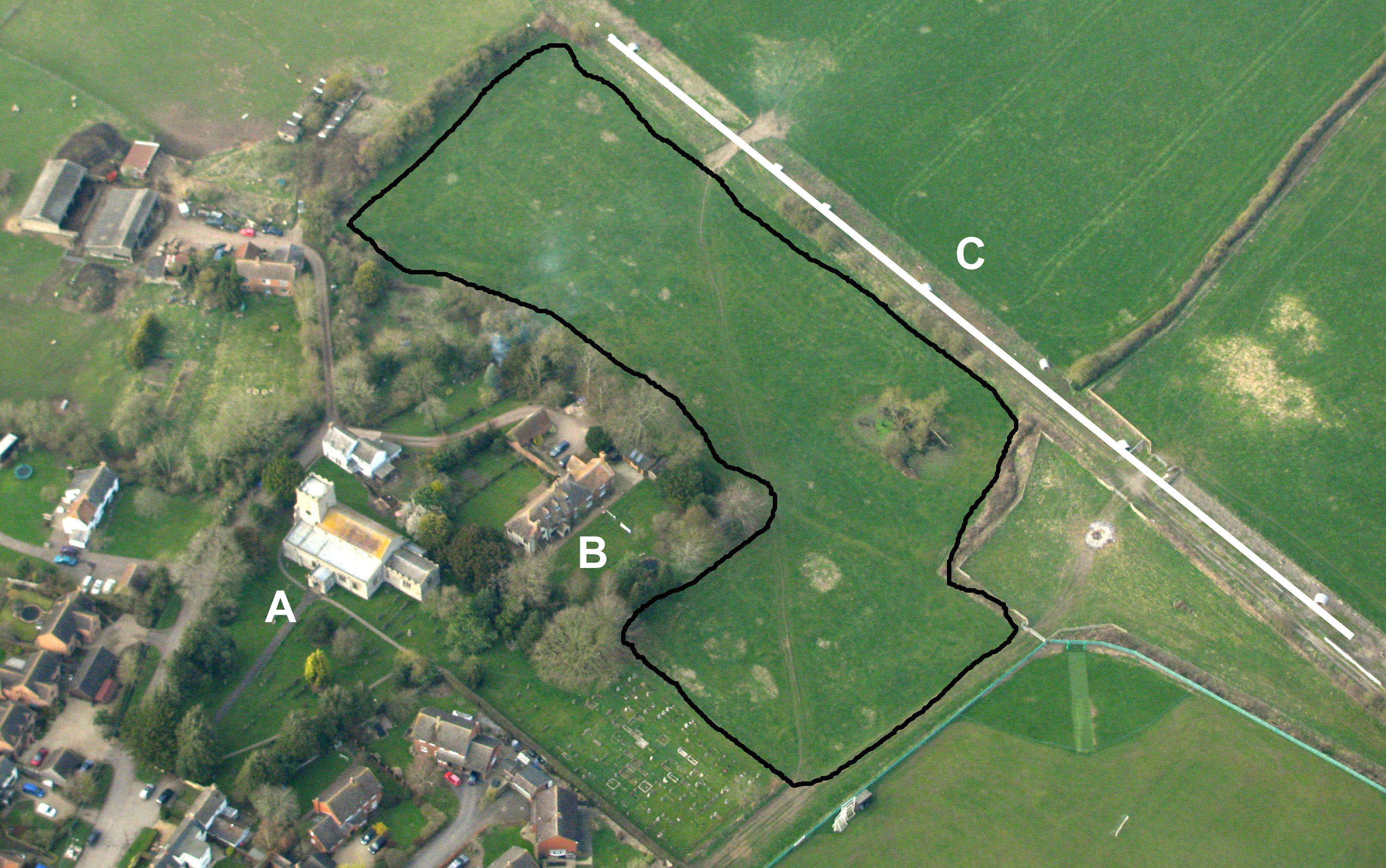 An L-shaped field to the east of the church (A) and north of St Mary's House (B) contains earthworks. These cover the whole area right
up to the fence that borders the disused line of the former Grand Central Railway (C) – which at this point is the exact line of
the proposed HS2 rail line.
An L-shaped field to the east of the church (A) and north of St Mary's House (B) contains earthworks. These cover the whole area right
up to the fence that borders the disused line of the former Grand Central Railway (C) – which at this point is the exact line of
the proposed HS2 rail line.
A BAS appraisal of the earthworks on 21 March 2011 noted a large rectangular enclosure with a well-defined ditch. St Mary's House would sit within this enclosure, suggesting that this marks the manorial centre of the medieval village. The other earthworks would indicate surrounding cottages, now long-deserted.
The danger from HS2 is that any ‘mitigation’ works such as high banks, fences or tree-planting between the line and the village would destroy the earthworks of this medieval manorial centre. [but see Note below]
UPDATE - January 2012
Following the conclusion of the government's HS2 Public Consultation, new route maps for HS2 were published in January 2012
showing amendments to the proposed line. At Twyford line has been moved around 120 metres further away from the village, which may provide
sufficient space to leave the monorial earthworks intact.
For full details and recommendations, see:
![]() Twyford Village earthworks : BAS Report 2011-02 June 2011
Twyford Village earthworks : BAS Report 2011-02 June 2011
![]() Twyford : BAS Response to the HS2 Environmental Statement - February 2014
Twyford : BAS Response to the HS2 Environmental Statement - February 2014
AERIAL PHOTO BY MIKE FARLEY